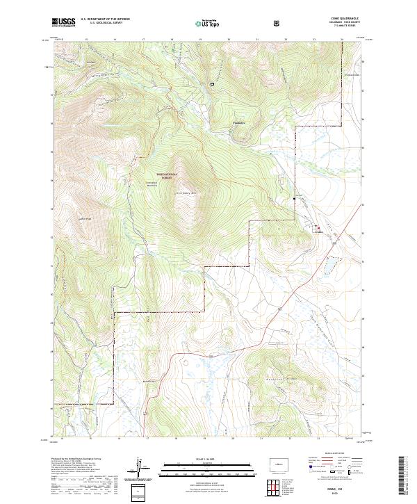
2022 Map of Como
USGS Topo · Published 2022About this map
Como sits at the eastern edge of this modern survey, reflecting its enduring position as a central point in the High Rockies. Historically a vital railroad hub, the settlement's layout is clearly defined alongside Como Lake and the Como Cem. The landscape is dominated by the steep rises of the Pike National Forest, where high-altitude peaks like Little Baldy Mtn and Palmer Peak overlook a complex network of historic gulches and water-management features.
Find a feature on this map
70 named features on this map. Tap any name to fly to it.
Don’t see what you’re looking for? This feature index may not catch every label — zoom into the map to look around manually.
Map Details
Editions of this 2022 Como Map
This is the sole edition of this map. No revisions or reprints were ever made.
Other maps of this area

1889 · Leadville
USGS Topo · 1:125,000

1891 · Leadville
USGS Topo · 1:125,000

1934 · Climax
USGS Topo · 1:48,000

1937 · Como
USGS Topo · 1:62,500

1938 · Mt. Lincoln
USGS Topo · 1:48,000

1942 · Leadville
USGS Topo · 1:125,000

1945 · Mount Lincoln
USGS Topo · 1:62,500

1953 · Denver
USGS Topo · 1:250,000

1956 · Elkhorn
USGS Topo · 1:24,000

1956 · Fairplay East
USGS Topo · 1:24,000