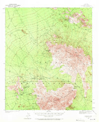
1937 Map of Comobabi
USGS Topo · Published 1971About this map
The North Comobabi Mountains and South Comobabi Mountains dominate this landscape within the Papago Indian Reservation. Surveyed in 1937, the map captures a network of small indigenous settlements and mining operations characteristic of Pima County in the early twentieth century. Clusters of activity are centered around water sources and mining claims, with scattered wells and springs supporting villages such as Ko Vaya, Sil Nakya, and Nolia.
Find a feature on this map
31 named features on this map. Tap any name to fly to it.
Don’t see what you’re looking for? This feature index may not catch every label — zoom into the map to look around manually.
Map Details
Editions of this 1937 Comobabi Map
4 editions found
Other maps of this area

1934 · Silver Bell
USGS Topo · 1:125,000

1937 · Comobabi
USGS Topo · 1:48,000

1938 · San Vicente
USGS Topo · 1:62,500

1941 · San Vicente
USGS Topo · 1:62,500

1941 · Baboquivari Peak
USGS Topo · 1:62,500

1941 · Sells
USGS Topo · 1:62,500

1942 · San Vicente
USGS Topo · 1:62,500

1942 · Comobabi
USGS Topo · 1:62,500

1943 · Sells
USGS Topo · 1:62,500

1943 · Fresnal
USGS Topo · 1:125,000