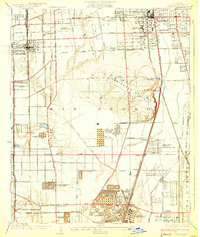
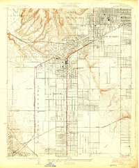
1930 Map of Compton
USGS Topo · Published 1930About this map
The Dominguez Hills dominate this 1930 survey, a landscape defined by the transition from agricultural tracts to a burgeoning industrial corridor. The map reveals an intensive concentration of petroleum infrastructure, including the Shell Oil Dominguez Refinery and numerous installations like the General Petroleum Tank Farm and Pan American Refinery near Watson. This industrial expansion is juxtaposed with established community landmarks such as the Gardena Japanese School, the Spanish American Institute, and the Compton Sanitarium. The drainage patterns of Nigger Slough and Compton Creek are visible alongside the straightening of the Los Angeles River channel. Key transportation arteries, including the Pacific Electric Railway and the Southern Pacific Railroad, illustrate the transit-oriented development patterns that connected Gardena, Compton, and the outlying settlements of Strawberry Park and Davidson City during the pre-war era.
Find a feature on this map
62 named features on this map. Tap any name to fly to it.
Don’t see what you’re looking for? This feature index may not catch every label — zoom into the map to look around manually.
Map Details
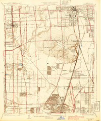
Editions of this 1930 Compton Map
2 editions found
Other maps of this area

1896 · Redondo
USGS Topo · 1:62,500

1896 · Downey
USGS Topo · 1:62,500

1899 · Downey
USGS Topo · 1:62,500

1901 · Southern California Sheet No. 1
USGS Topo · 1:250,000

1902 · Downey
USGS Topo · 1:62,500

1904 · Southern California Sheet No. 1
USGS Topo · 1:250,000
1923 · Bell
USGS Topo · 1:24,000

1923 · Wilmington
USGS Topo · 1:24,000
1923 · Watts
USGS Topo · 1:24,000
1924 · Inglewood
USGS Topo · 1:24,000