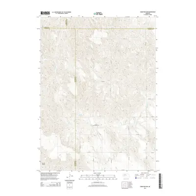
2014 Map of Comstock NW
USGS Topo · Published 2014About this map
Bohemian Brotherhood Cem stands as a central cultural landmark in this rural landscape where Custer, Loup, Garfield, and Valley counties meet. The terrain is defined by a dense network of drainages including Sioux Cr and the N Br Turtle Cr, the latter of which feeds into the Rejda Reservoir. This 2014 survey illustrates a highly structured grid of section roads like Alps Rd and Flume Rd that traverse the dissected upland topography. Notable natural landmarks such as Big Oak Canyon break the rhythm of the hills, indicating the sharp relief found in this portion of the Nebraska sandhills region. The map preserves the specific locations of rural infrastructure and water management features essential to the agricultural operations across these four county lines.
Find a feature on this map
23 named features on this map. Tap any name to fly to it.
Don’t see what you’re looking for? This feature index may not catch every label — zoom into the map to look around manually.
Map Details
Editions of this 2014 Comstock NW Map
This is the sole edition of this map. No revisions or reprints were ever made.
Other maps of this area

1952 · Burwell
USGS Topo · 1:24,000

1952 · Sargent East
USGS Topo · 1:24,000

1952 · Elyria
USGS Topo · 1:24,000

1952 · Sargent SE
USGS Topo · 1:24,000

1952 · Burwell SE
USGS Topo · 1:24,000

1952 · Comstock
USGS Topo · 1:24,000

1952 · Taylor SE
USGS Topo · 1:24,000

1952 · Comstock NW
USGS Topo · 1:24,000

1952 · Comstock SE
USGS Topo · 1:24,000

1955 · Broken Bow
USGS Topo · 1:250,000