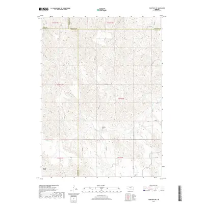
2017 Map of Comstock NW
USGS Topo · Published 2017About this map
The intersection of four Nebraska counties—Loup, Garfield, Custer, and Valley—is defined by a network of drainage systems and isolated landmarks. The terrain is marked by the winding path of Sioux Cr in the northwest and N Br Turtle Cr to the southeast, illustrating the natural flow through this rural interior. Cultural history is anchored by the Bohemian Brotherhood Cem and Bohemian Cem, reflecting the early Central European settlement patterns that shaped the social geography of the Great Plains.
Find a feature on this map
35 named features on this map. Tap any name to fly to it.
Don’t see what you’re looking for? This feature index may not catch every label — zoom into the map to look around manually.
Map Details
Editions of this 2017 Comstock NW Map
This is the sole edition of this map. No revisions or reprints were ever made.
Other maps of this area

1952 · Burwell
USGS Topo · 1:24,000

1952 · Sargent East
USGS Topo · 1:24,000

1952 · Elyria
USGS Topo · 1:24,000

1952 · Sargent SE
USGS Topo · 1:24,000

1952 · Burwell SE
USGS Topo · 1:24,000

1952 · Comstock
USGS Topo · 1:24,000

1952 · Taylor SE
USGS Topo · 1:24,000

1952 · Comstock NW
USGS Topo · 1:24,000

1952 · Comstock SE
USGS Topo · 1:24,000

1955 · Broken Bow
USGS Topo · 1:250,000