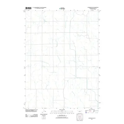
2011 Map of Comstock SE
USGS Topo · Published 2011About this map
The rolling plains of Valley County are defined by a network of drainage systems feeding into larger local watersheds. This landscape, as it appeared in the early 21st century, is carved by South Branch Turtle Creek and Dane Creek in the northern and eastern portions, while Hawthorne Creek and Hays Creek drain the southern reaches. The grid-based road system typical of Nebraska's agricultural heartland is represented here by primary thoroughfares such as Sargent Rd and Comstock Rd, which provide the essential connectivity between dispersed farmsteads and the regional centers of Comstock and Sargent beyond the map's borders. The terrain is relatively sparse in terms of named settlements, highlighting the vast open spaces and rural character of the Nebraska sandhills region.
Find a feature on this map
6 named features on this map. Tap any name to fly to it.
Don’t see what you’re looking for? This feature index may not catch every label — zoom into the map to look around manually.
Map Details
Editions of this 2011 Comstock SE Map
This is the sole edition of this map. No revisions or reprints were ever made.
Other maps of this area

1899 · Loup
USGS Topo · 1:125,000

1951 · Arcadia West
USGS Topo · 1:24,000

1951 · Arcadia East
USGS Topo · 1:24,000

1952 · Elyria
USGS Topo · 1:24,000

1952 · Comstock
USGS Topo · 1:24,000

1952 · Comstock NW
USGS Topo · 1:24,000

1952 · Comstock SE
USGS Topo · 1:24,000

1953 · Loup City NW
USGS Topo · 1:24,000

1954 · Ord
USGS Topo · 1:24,000

1954 · Ord NW
USGS Topo · 1:24,000