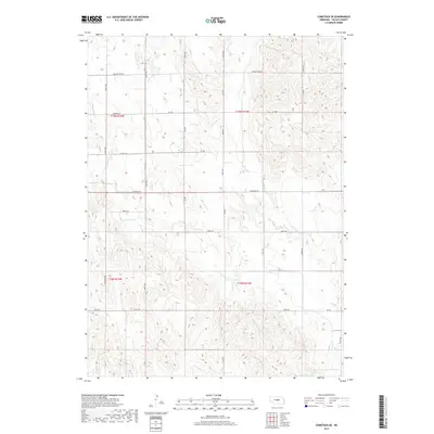
2017 Map of Comstock SE
USGS Topo · Published 2017About this map
S Br Turtle Cr and Dane Cr thread through this section of Valley County, defining a landscape shaped by narrow drainage basins and agricultural section lines. This 2017 survey shows the enduring grid of rural Nebraska, where essential transit routes like Sargent-Ord Rd and Comstock Rd provide the primary connectivity between spread-out homesteads and larger regional hubs. The presence of smaller watercourses like Hawthorne Cr and Haus Cr reveals the subtle topography that dictates the placement of farm roads and fields. Mapping of North-South thoroughfares, including 470th Ave and 473rd Ave, illustrates how the modern road network adheres strictly to the township and range system, preserving the spatial organization established during early settlement despite contemporary improvements.
Find a feature on this map
27 named features on this map. Tap any name to fly to it.
Don’t see what you’re looking for? This feature index may not catch every label — zoom into the map to look around manually.
Map Details
Editions of this 2017 Comstock SE Map
This is the sole edition of this map. No revisions or reprints were ever made.
Other maps of this area

1899 · Loup
USGS Topo · 1:125,000

1951 · Arcadia West
USGS Topo · 1:24,000

1951 · Arcadia East
USGS Topo · 1:24,000

1952 · Elyria
USGS Topo · 1:24,000

1952 · Comstock
USGS Topo · 1:24,000

1952 · Comstock NW
USGS Topo · 1:24,000

1952 · Comstock SE
USGS Topo · 1:24,000

1953 · Loup City NW
USGS Topo · 1:24,000

1954 · Ord
USGS Topo · 1:24,000

1954 · Ord NW
USGS Topo · 1:24,000