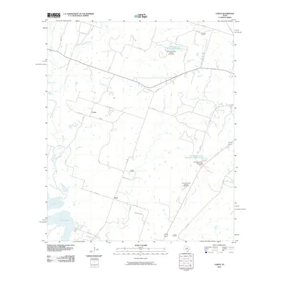
2010 Map of Comyn
USGS Topo · Published 2010About this map
Comyn and Roch anchor this landscape of rural Erath County, where the headwaters of Proctor Lake begin to collect from numerous local drainages. The Leon River winds through the western portion of the quadrangle, joined by tributaries like Armstrong Creek, Walker Creek, and Mill Branch. The mapping reveals a detailed network of county roads, such as Co RD 434 and Co RD 442, that connect isolated family sites and agricultural operations. Historical researchers will find several well-preserved burial grounds, including Cow Creek Cemetery in the north and Hanson Cemetery situated along Sowells Creek. Significant water management features are evident through the work of the Soil Conservation Service Site 25 and similar sites, which illustrate the mid-century infrastructure efforts to manage the Central Texas watershed before it reaches the larger reservoir to the south.
Find a feature on this map
43 named features on this map. Tap any name to fly to it.
Don’t see what you’re looking for? This feature index may not catch every label — zoom into the map to look around manually.
Map Details
Editions of this 2010 Comyn Map
This is the sole edition of this map. No revisions or reprints were ever made.
Other maps of this area

1888 · Hamilton
USGS Topo · 1:125,000

1889 · Brownwood
USGS Topo · 1:125,000

1890 · Stephenville
USGS Topo · 1:125,000

1894 · Hamilton
USGS Topo · 1:125,000

1894 · Eastland
USGS Topo · 1:125,000

1894 · Brownwood
USGS Topo · 1:125,000

1920 · Stephenville
USGS Topo · 1:125,000

1954 · Brownwood
USGS Topo · 1:250,000

1954 · Abilene
USGS Topo · 1:250,000

1956 · Gustine
USGS Topo · 1:62,500