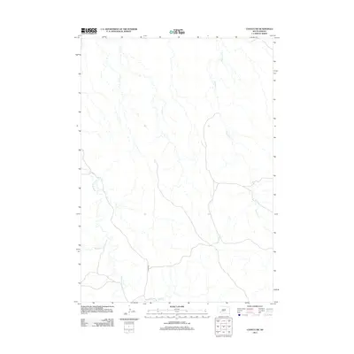
2012 Map of Conata SW
USGS Topo · Published 2012About this map
Medicine Root Creek and its complex network of seasonal tributaries define this high plains landscape in the early 21st century. The map provides a detailed view of the water drainage patterns typical of this region, where Redwater Creek and Mousseaux Creek carve subtle paths through the terrain. Human infrastructure is notably sparse, represented primarily by the winding course of River Road and a few unnamed local routes. The geography is characterized by the convergence of these creeks toward Mud Creek, illustrating the natural hydrological flow of the South Dakota prairie before these waters eventually join larger river systems outside the quadrangle.
Find a feature on this map
5 named features on this map. Tap any name to fly to it.
Don’t see what you’re looking for? This feature index may not catch every label — zoom into the map to look around manually.
Map Details
Editions of this 2012 Conata SW Map
This is the sole edition of this map. No revisions or reprints were ever made.
Other maps of this area

1950 · Conata
USGS Topo · 1:24,000

1950 · Conata SW
USGS Topo · 1:24,000

1950 · Imlay SE
USGS Topo · 1:24,000

1950 · Bouquet Table
USGS Topo · 1:24,000

1952 · Conata NE
USGS Topo · 1:24,000

1952 · Bouquet Table
USGS Topo · 1:24,000

1952 · Conata SE
USGS Topo · 1:24,000

1952 · Conata
USGS Topo · 1:24,000

1955 · Hot Springs
USGS Topo · 1:250,000

1981 · Wall
USGS Topo · 1:100,000