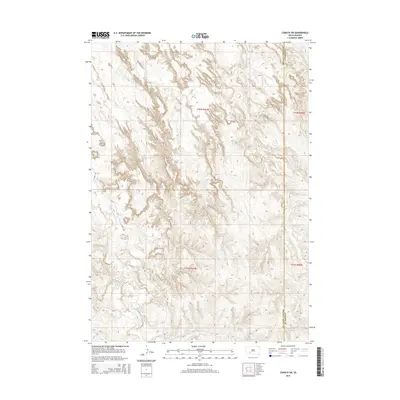
2015 Map of Conata SW
USGS Topo · Published 2015About this map
Medicine Root Creek and Redwater Creek carve through the highly dissected terrain along the boundary of Oglala Lakota and Jackson Counties. This 2015 survey illustrates a landscape primarily defined by its natural drainage patterns rather than dense human settlement. A few critical transportation corridors, including River Road and Bia-25, provide the only significant access through the complex network of ridges and coulees. The intricate contour lines reveal the deep erosion typical of this region, where Mud Creek joins the larger water systems. For those studying the geography of southwestern South Dakota, the map provides precise data on the interaction between established county lines and the physical obstacles of the land.
Find a feature on this map
10 named features on this map. Tap any name to fly to it.
Don’t see what you’re looking for? This feature index may not catch every label — zoom into the map to look around manually.
Map Details
Editions of this 2015 Conata SW Map
This is the sole edition of this map. No revisions or reprints were ever made.
Other maps of this area

1950 · Conata
USGS Topo · 1:24,000

1950 · Conata SW
USGS Topo · 1:24,000

1950 · Imlay SE
USGS Topo · 1:24,000

1950 · Bouquet Table
USGS Topo · 1:24,000

1952 · Conata NE
USGS Topo · 1:24,000

1952 · Bouquet Table
USGS Topo · 1:24,000

1952 · Conata SE
USGS Topo · 1:24,000

1952 · Conata
USGS Topo · 1:24,000

1955 · Hot Springs
USGS Topo · 1:250,000

1981 · Wall
USGS Topo · 1:100,000