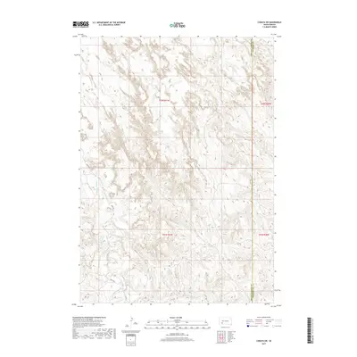
2017 Map of Conata SW
USGS Topo · Published 2017About this map
The erosional badlands of the White River drainage define the landscape of this region along the border of Oglala Lakota Co and Jackson Co. The map reveals a complex network of ephemeral and perennial waterways, most notably the winding path of Medicine Root Cr and Redwater Cr. These drainages create a intricate topography that has historically shaped movement and settlement patterns within the Pine Ridge area. Transportation in this section of South Dakota is sparse, limited to a handful of tracks including River Rd, Route Rd, and N Rt 80 which traverse the breaks and ridges. Smaller drainages like Mousseaux Cr and Mud Cr feed the larger basins, illustrating the delicate hydrologic system of the western plains.
Find a feature on this map
12 named features on this map. Tap any name to fly to it.
Don’t see what you’re looking for? This feature index may not catch every label — zoom into the map to look around manually.
Map Details
Editions of this 2017 Conata SW Map
This is the sole edition of this map. No revisions or reprints were ever made.
Other maps of this area

1950 · Conata
USGS Topo · 1:24,000

1950 · Conata SW
USGS Topo · 1:24,000

1950 · Imlay SE
USGS Topo · 1:24,000

1950 · Bouquet Table
USGS Topo · 1:24,000

1952 · Conata NE
USGS Topo · 1:24,000

1952 · Bouquet Table
USGS Topo · 1:24,000

1952 · Conata SE
USGS Topo · 1:24,000

1952 · Conata
USGS Topo · 1:24,000

1955 · Hot Springs
USGS Topo · 1:250,000

1981 · Wall
USGS Topo · 1:100,000