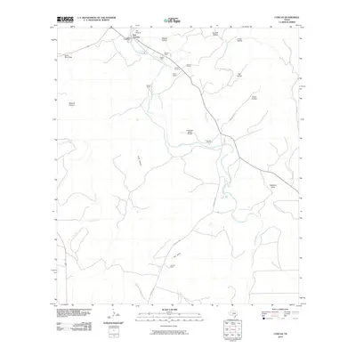
2010 Map of Concan
USGS Topo · Published 2010About this map
The Frio River carves through this Uvalde County landscape, defining the character of Concan and its surrounding ranchland. This 2010 survey highlights a region of canyons and hollows, where family-owned tracts like Meyer Ranch, Fitzgerald Ranch, and Big Tree Ranch dominate the geography. Notable local landmarks include The Big Tree and the geographic pinch point known as The Shut-In at the river's First Crossing.
Find a feature on this map
30 named features on this map. Tap any name to fly to it.
Don’t see what you’re looking for? This feature index may not catch every label — zoom into the map to look around manually.
Map Details
Editions of this 2010 Concan Map
This is the sole edition of this map. No revisions or reprints were ever made.
Other maps of this area

1898 · Uvalde
USGS Topo · 1:125,000

1899 · Uvalde
USGS Topo · 1:125,000

1954 · San Antonio
USGS Topo · 1:250,000

1956 · Utopia
USGS Topo · 1:62,500

1957 · San Antonio
USGS Topo · 1:250,000

1957 · York Hollow
USGS Topo · 1:62,500

1960 · Concan
USGS Topo · 1:24,000

1960 · Magers Crossing
USGS Topo · 1:24,000
1969 · Trio
USGS Topo · 1:24,000
1969 · Utopia
USGS Topo · 1:24,000