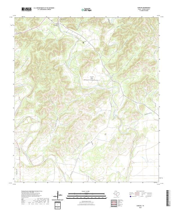
2022 Map of Concan
USGS Topo · Published 2022About this map
Frio River and the Dry Frio River carve through the limestone landscape of Uvalde County in this modern survey. The settlement of Concan serves as a central hub, flanked by the topographic narrows of The Shut-In and the prominent Silver Mine Pass to the northwest. This area is defined by its drainage network, where numerous hollows and draws—including Baylock Hollow, Pear Hollow, and Sawmill Canyon—feed into the river system. Local infrastructure and land use are represented by the Concan Cem and the Annandale Ranch Airport, illustrating the mixture of historical sites and private ranching aviation. The road network, featuring Ranch Rd 2690 and Ten Mile Rd, navigates the complex terrain between Brushy Creek and Hackberry Cr, providing access to the various canyons and seasonal creek beds like Elm Draw and Dinner Cr.
Find a feature on this map
25 named features on this map. Tap any name to fly to it.
Don’t see what you’re looking for? This feature index may not catch every label — zoom into the map to look around manually.
Map Details
Editions of this 2022 Concan Map
This is the sole edition of this map. No revisions or reprints were ever made.
Other maps of this area

1898 · Uvalde
USGS Topo · 1:125,000

1899 · Uvalde
USGS Topo · 1:125,000

1954 · San Antonio
USGS Topo · 1:250,000

1956 · Utopia
USGS Topo · 1:62,500

1957 · San Antonio
USGS Topo · 1:250,000

1957 · York Hollow
USGS Topo · 1:62,500

1960 · Concan
USGS Topo · 1:24,000

1960 · Magers Crossing
USGS Topo · 1:24,000
1969 · Trio
USGS Topo · 1:24,000
1969 · Utopia
USGS Topo · 1:24,000