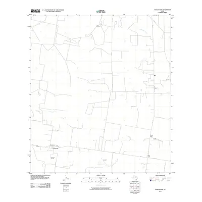
2010 Map of Concepcion
USGS Topo · Published 2010About this map
Concepcion serves as the primary hub in this South Texas landscape, where the confluence of Macho Creek and Los Olmos Creek defines the local topography. The map illustrates a rural settlement pattern deeply connected to family lineages and small communities, featuring several distinct burial grounds such as Perez Cemetery, Velas Cemetery, and the Concepcion Cemetery. To the north, the North Concepcion Oil Field indicates the region's industrial ties to energy production, while the 4-G Ranch Airport suggests the importance of private aviation in navigating these wide-reaching ranch lands.
Find a feature on this map
34 named features on this map. Tap any name to fly to it.
Don’t see what you’re looking for? This feature index may not catch every label — zoom into the map to look around manually.
Map Details
Editions of this 2010 Concepcion Map
This is the sole edition of this map. No revisions or reprints were ever made.
Other maps of this area

1917 · Ben Bolt
USGS Topo · 1:62,500

1921 · Falfurrias
USGS Topo · 1:125,000

1956 · Benavides
USGS Topo · 1:62,500

1956 · Laredo
USGS Topo · 1:250,000

1963 · Premont West
USGS Topo · 1:24,000
1963 · Palito Blanco
USGS Topo · 1:24,000
1963 · Seeligson Ranch
USGS Topo · 1:24,000

1968 · Concepcion
USGS Topo · 1:24,000

1968 · San Jose
USGS Topo · 1:24,000

1968 · Benavides
USGS Topo · 1:24,000