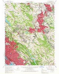
1959 Map of Concord
USGS Topo · Published 1967About this map
The hills and canyons of Contra Costa and Alameda counties show a mix of rapid post-war suburban growth and protected open space at the end of the 1950s. Urban centers like Concord, Walnut Creek, and Oakland expand into the valleys, while the ridges of Briones Hills and Las Trampas Ridge remain largely undeveloped. The transportation network is in transition, featuring established rail lines like the Southern Pacific and the Sacramento Northern alongside newer corridors such as the Nimitz Freeway and Warren Blvd.
Find a feature on this map
89 named features on this map. Tap any name to fly to it.
Don’t see what you’re looking for? This feature index may not catch every label — zoom into the map to look around manually.
Map Details
Editions of this 1959 Concord Map
2 editions found
Other maps of this area

1892 · San Mateo
USGS Topo · 1:62,500

1895 · San Francisco
USGS Topo · 1:62,500

1896 · San Mateo
USGS Topo · 1:62,500

1896 · Carquinez Strait
USGS Topo · 1:62,500

1896 · Mt. Diablo
USGS Topo · 1:62,500

1897 · Concord
USGS Topo · 1:62,500

1898 · Karquines
USGS Topo · 1:62,500

1898 · Mt. Diablo
USGS Topo · 1:62,500

1899 · San Francisco
USGS Topo · 1:62,500

1899 · Haywards
USGS Topo · 1:62,500