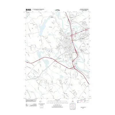
2012 Map of Concord
USGS Topo · Published 2012About this map
The Merrimack River bisects this capital city landscape, serving as the central axis for a complex network of established neighborhoods and institutional grounds. To the west, the sprawling campus of Saint Pauls School sits near Millville Cem, while the city’s civic core is anchored by the New Hampshire State Office Park and various historic burial grounds including Blossom Hill Cem and Old North Cem. The terrain is defined by prominent elevations such as Rattlesnake Hill and Rum Hill, which overlook the industrial and residential corridors of West Concord and Concord Heights. In the southern reaches, the convergence of Turkey River and Bela Brook near Bow Junction highlights the importance of waterpower and transit in the region’s development. This survey also details the extensive shoreline of Penacook Lake, the city's primary reservoir, and the transition into more agrarian spaces like Carter Hill Orchard on the western fringe.
Find a feature on this map
237 named features on this map. Tap any name to fly to it.
Don’t see what you’re looking for? This feature index may not catch every label — zoom into the map to look around manually.
Map Details
Editions of this 2012 Concord Map
This is the sole edition of this map. No revisions or reprints were ever made.
Other maps of this area

1919 · Gilmanton
USGS Topo · 1:62,500

1921 · Suncook
USGS Topo · 1:62,500

1927 · Concord
USGS Topo · 1:62,500

1927 · Penacook
USGS Topo · 1:62,500

1927 · Gilmanton
USGS Topo · 1:62,500

1944 · Suncook
USGS Topo · 1:62,500

1949 · Portland
USGS Topo · 1:250,000

1949 · Concord
USGS Topo · 1:62,500

1956 · Penacook
USGS Topo · 1:62,500

1956 · Portland
USGS Topo · 1:250,000