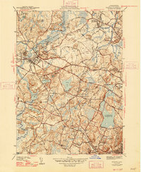
1943 Map of Concord
USGS Topo · Published 1947About this map
Concord River and the Assabet River converge at the heart of this Middlesex County landscape, where the town of Concord serves as a hub for both the local rail network and the surrounding hills. In the mid-1940s, the terrain south of the town center is dominated by the Walden Pond State Reservation, while the growing footprint of the Bedford Airport reflects the expanding infrastructure of the era. The mapping of the Cambridge Reservoir and the Pumping Sta nearby underscores the regional importance of water management for the neighboring metropolitan areas. Local history and genealogy interest is concentrated in the many named hills and burial sites, including the Old Burying Ground in Lincoln and the Lincoln Cem. Educational institutions like Middlesex Sch and Weston College appear as prominent landmarks amidst a complex web of brooks and turnpikes.
Find a feature on this map
60 named features on this map. Tap any name to fly to it.
Don’t see what you’re looking for? This feature index may not catch every label — zoom into the map to look around manually.
Map Details
Editions of this 1943 Concord Map
4 editions found
Other maps of this area

1886 · Lawrence
USGS Topo · 1:62,500

1886 · Lowell
USGS Topo · 1:62,500

1886 · Framingham
USGS Topo · 1:62,500

1888 · Lawrence
USGS Topo · 1:62,500

1889 · Framingham
USGS Topo · 1:62,500

1893 · Lowell
USGS Topo · 1:62,500

1893 · Boston
USGS Topo · 1:62,500

1893 · Lawrence
USGS Topo · 1:62,500

1894 · Framingham
USGS Topo · 1:62,500

1903 · Boston
USGS Topo · 1:62,500