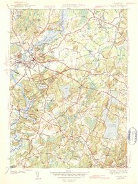
1943 Map of Concord
USGS Topo · Published 1943About this map
Authors Ridge and Revolutionary Ridge overlook the historic landscape of Concord, where the Assabet River and Sudbury River converge to form the Concord Great Meadows. This 1940s survey illustrates a region deeply connected to American literary and revolutionary history, featuring landmarks like the Old North Bridge and the Old Burying Ground. To the south, the Walden Pond State Reservation remains largely undeveloped, preserving Emersons Cliff and the shoreline made famous by Henry David Thoreau. The Boston and Maine Railroad provides the primary infrastructure link, connecting the village centers of Lincoln, South Lincoln, and Silver Hill. Large educational and civic institutions, including Middlesex Sch and Weston College, appear alongside numerous burial sites like Sleepy Hollow Cem, reflecting the town's role as a cultural and intellectual hub of Middlesex County.
Find a feature on this map
114 named features on this map. Tap any name to fly to it.
Don’t see what you’re looking for? This feature index may not catch every label — zoom into the map to look around manually.
Map Details
Editions of this 1943 Concord Map
4 editions found
Other maps of this area

1886 · Lawrence
USGS Topo · 1:62,500

1886 · Lowell
USGS Topo · 1:62,500

1886 · Framingham
USGS Topo · 1:62,500

1888 · Lawrence
USGS Topo · 1:62,500

1889 · Framingham
USGS Topo · 1:62,500

1893 · Lowell
USGS Topo · 1:62,500

1893 · Boston
USGS Topo · 1:62,500

1893 · Lawrence
USGS Topo · 1:62,500

1894 · Framingham
USGS Topo · 1:62,500

1903 · Boston
USGS Topo · 1:62,500