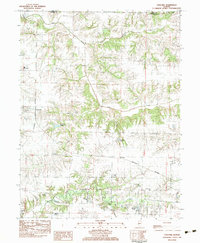
1983 Map of Concord
USGS Topo · Published 1983About this map
Indian Creek and Little Indian Creek carve through the agricultural landscape north of the village of Concord, where the Burlington Northern railroad serves as a primary corridor for the region's movement. This area of Morgan County is notable for its high density of family and community burial grounds, including the Mt Vernon Cem, Angel Cem, and Walnut Grove Cem, which dot the uplands between the creek branches. Farther south, the County Farm Cem and Caldwell Cem reflect the rural social history and settlement patterns near Joy Prairie. The terrain is defined by the drainage basins of Mauvaise Terre Creek and Lick Creek, while specialized features like the Williams Landing Strip and the Triopia High Sch campus indicate the modern rural infrastructure. Water management for the local community is evident at the Concord Reservoir, and recreational or agricultural water sources such as Roegge Lake and Leland Lake are scattered throughout the southern half of the quadrangle.
Find a feature on this map
27 named features on this map. Tap any name to fly to it.
Don’t see what you’re looking for? This feature index may not catch every label — zoom into the map to look around manually.
Map Details
Editions of this 1983 Concord Map
This is the sole edition of this map. No revisions or reprints were ever made.
Other maps of this area

1924 · Winchester
USGS Topo · 1:48,000

1926 · Winchester
USGS Topo · 1:62,500

1929 · Arenzville
USGS Topo · 1:62,500

1932 · Arenzville
USGS Topo · 1:62,500

1932 · Jacksonville
USGS Topo · 1:62,500

1932 · Virginia
USGS Topo · 1:62,500

1936 · Virginia
USGS Topo · 1:62,500

1937 · Jacksonville
USGS Topo · 1:62,500

1948 · Quincy
USGS Topo · 1:250,000

1956 · Quincy
USGS Topo · 1:250,000