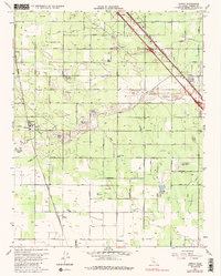
1963 Map of Conejo
USGS Topo · Published 1985About this map
The agricultural landscape of Fresno County unfolds in this 1963 survey, characterized by an extensive irrigation network and rail-dependent settlements. Tiny hubs like Bowles, Monmouth, and Conejo are anchored by the dual presence of the Southern Pacific and Atchison Topeka and Santa Fe railroads, which cut diagonally across the grid of section roads and canals. Local education and community life are represented by several country school sites, including Monroe Sch, Terry Union Sch, and Conejo Sch.
Find a feature on this map
44 named features on this map. Tap any name to fly to it.
Don’t see what you’re looking for? This feature index may not catch every label — zoom into the map to look around manually.
Map Details
Editions of this 1963 Conejo Map
4 editions found
Other maps of this area

1923 · Malaga
USGS Topo · 1:31,680

1923 · Fresno
USGS Topo · 1:31,680

1923 · Sanger
USGS Topo · 1:31,680

1924 · Riverdale
USGS Topo · 1:31,680

1924 · Selma
USGS Topo · 1:31,680

1924 · Conejo
USGS Topo · 1:31,680

1925 · Caruthers
USGS Topo · 1:31,680

1926 · Burris Park
USGS Topo · 1:31,680

1927 · Laton
USGS Topo · 1:31,680

1927 · Riverdale
USGS Topo · 1:31,680