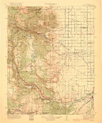
1922 Map of Conejos
USGS Topo · Published 1922About this map
The Alamosa River and Conejos River valleys dominate this 1920 survey of southern Colorado, revealing a landscape where high-altitude ranching and agriculture meet the San Luis Valley. Settlement is concentrated in the east along the Denver and Rio Grande River railroad line, serving communities such as Antonito, Guadalupe, and Mogote. The map provides a detailed look at the rural infrastructure of the era, from the concentration of educational and religious life at Bowen School and Bowen Church to remote mountain outposts like the Toltec Section House and River Springs Ranger Sta.
Find a feature on this map
131 named features on this map. Tap any name to fly to it.
Don’t see what you’re looking for? This feature index may not catch every label — zoom into the map to look around manually.
Map Details
Editions of this 1922 Conejos Map
4 editions found
Other maps of this area

1913 · Summitville
USGS Topo · 1:125,000

1914 · Creede
USGS Topo · 1:125,000

1915 · Summitville
USGS Topo · 1:125,000

1915 · Del Norte
USGS Topo · 1:125,000

1916 · Creede
USGS Topo · 1:125,000

1917 · Del Norte
USGS Topo · 1:125,000

1918 · Tusas
USGS Topo · 1:125,000

1922 · Conejos
USGS Topo · 1:125,000

1945 · Durango
USGS Topo · 1:250,000

1953 · Durango
USGS Topo · 1:250,000