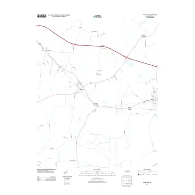
2013 Map of Conetoe
USGS Topo · Published 2013About this map
Conetoe and Bethel anchor this 2013 topographic survey of the North Carolina coastal plain, a landscape defined by an extensive network of drainage infrastructure. The presence of Thomas Canal, Ballahack Canal, and Mitchell Swamp Canal alongside the natural winding of Conetoe Cr illustrates the long-standing management of this low-lying agricultural region. These waterways have historically been essential for reclaiming the rich soils of the swampy terrain for farming, a pattern visible in the numerous rural roads named for local families such as Burnette Farm Rd and Bryant Farm Rd.
Find a feature on this map
82 named features on this map. Tap any name to fly to it.
Don’t see what you’re looking for? This feature index may not catch every label — zoom into the map to look around manually.
Map Details
Editions of this 2013 Conetoe Map
This is the sole edition of this map. No revisions or reprints were ever made.
Other maps of this area

1901 · Parmele
USGS Topo · 1:62,500

1902 · Parmele
USGS Topo · 1:62,500

1902 · Tarboro
USGS Topo · 1:62,500

1903 · Tarboro
USGS Topo · 1:62,500

1903 · Winterville
USGS Topo · 1:62,500

1904 · Falkland
USGS Topo · 1:62,500

1905 · Winterville
USGS Topo · 1:62,500

1953 · Rocky Mount
USGS Topo · 1:250,000

1954 · Rocky Mount
USGS Topo · 1:250,000

1980 · Falkland
USGS Topo · 1:24,000