
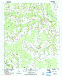
1980 Map of Falkland
USGS Topo · Published 1981About this map
The Tar River meanders through the northeastern reaches of this Pitt County landscape, historically serving as a vital artery for the region. Near its banks, Dupree Landing and the small town of Falkland anchor a network of rural settlements and crossroads that define the local geography. The map reveals a dense distribution of community centers, including Sharp Point, Cobb Town, and the curiously named California, each often centered around family landmarks and local congregations like St Johns Ch and Otter Creek Ch.
Find a feature on this map
31 named features on this map. Tap any name to fly to it.
Don’t see what you’re looking for? This feature index may not catch every label — zoom into the map to look around manually.
Map Details
Editions of this 1980 Falkland Map
2 editions found
Other maps of this area

1901 · Parmele
USGS Topo · 1:62,500

1902 · Parmele
USGS Topo · 1:62,500

1902 · Tarboro
USGS Topo · 1:62,500

1903 · Tarboro
USGS Topo · 1:62,500

1903 · Winterville
USGS Topo · 1:62,500

1904 · Falkland
USGS Topo · 1:62,500

1905 · Winterville
USGS Topo · 1:62,500

1953 · Rocky Mount
USGS Topo · 1:250,000

1954 · Rocky Mount
USGS Topo · 1:250,000
1980 · Pinetops
USGS Topo · 1:24,000