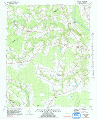
1980 Map of Falkland
USGS Topo · Published 1992About this map
The Tar River flows along the eastern edge of this coastal plain landscape, defining the rural character of Pitt County in the early 1980s. A network of small farming communities and crossroads is interconnected by winding country roads, with Falkland and Cobb Town serving as local anchors. The map reveals a high density of rural spiritual life, with numerous churches such as Dildys Chapel, Seven Holly Ch, and St Peters Ch distributed across the acreage.
Find a feature on this map
30 named features on this map. Tap any name to fly to it.
Don’t see what you’re looking for? This feature index may not catch every label — zoom into the map to look around manually.
Map Details
Editions of this 1980 Falkland Map
2 editions found

Other maps of this area

1901 · Parmele
USGS Topo · 1:62,500

1902 · Parmele
USGS Topo · 1:62,500

1902 · Tarboro
USGS Topo · 1:62,500

1903 · Tarboro
USGS Topo · 1:62,500

1903 · Winterville
USGS Topo · 1:62,500

1904 · Falkland
USGS Topo · 1:62,500

1905 · Winterville
USGS Topo · 1:62,500

1953 · Rocky Mount
USGS Topo · 1:250,000

1954 · Rocky Mount
USGS Topo · 1:250,000
1980 · Pinetops
USGS Topo · 1:24,000