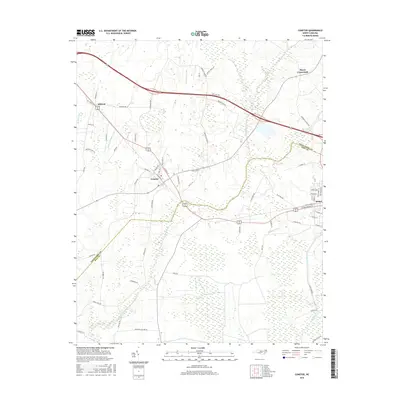
2016 Map of Conetoe
USGS Topo · Published 2016About this map
Conetoe and Bethel anchor this coastal plain landscape where the boundary between Edgecombe Co and Pitt Co intersects a complex network of agricultural drainage. The terrain is defined by a dense system of waterways designed to manage the low-lying basin, including the Mitchell Swamp Canal, Ballyhack Canal, and the extensive Thomas Canal. These engineered features sit alongside natural drainage such as Conetoe Cr and Grindle Cr, illustrating the long-standing efforts to reclaim and maintain the surrounding farmland. Smaller clusters like Mildred and Mayos Crossroads are connected by a web of rural roads, such as Ballyhack Ln and Penny Hill Rd, which trace the historical land divisions and family holdings typical of this North Carolina tobacco and cotton country. The map captures the quiet persistence of these small-town centers and their reliance on the sophisticated water management systems that keep the fertile land productive.
Find a feature on this map
67 named features on this map. Tap any name to fly to it.
Don’t see what you’re looking for? This feature index may not catch every label — zoom into the map to look around manually.
Map Details
Editions of this 2016 Conetoe Map
This is the sole edition of this map. No revisions or reprints were ever made.
Other maps of this area

1901 · Parmele
USGS Topo · 1:62,500

1902 · Parmele
USGS Topo · 1:62,500

1902 · Tarboro
USGS Topo · 1:62,500

1903 · Tarboro
USGS Topo · 1:62,500

1903 · Winterville
USGS Topo · 1:62,500

1904 · Falkland
USGS Topo · 1:62,500

1905 · Winterville
USGS Topo · 1:62,500

1953 · Rocky Mount
USGS Topo · 1:250,000

1954 · Rocky Mount
USGS Topo · 1:250,000

1980 · Falkland
USGS Topo · 1:24,000