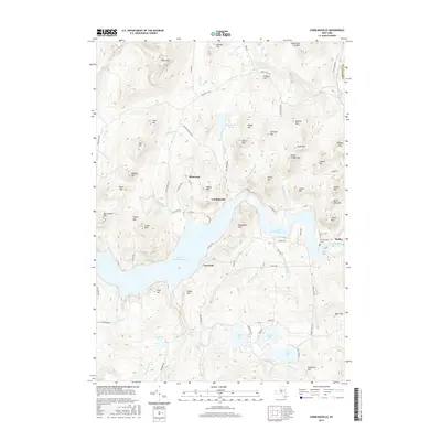
2016 Map of Conklingville
USGS Topo · Published 2016About this map
Great Sacandaga Lake dominates this portion of the Adirondack foothills, where the engineered landscape meets the steep elevations of the Southern Adirondacks. The hamlet of Conklingville is positioned near the dam site where the Sacandaga River exits the reservoir, a location critical to the water management history of the region. Local genealogy and land use can be traced through the Conklingville Cems and small settlements like Allentown and Overlook. The terrain is defined by numerous peaks including Canada Hill, West Mtn, and White Mtn, which frame a series of smaller water bodies such as Efner Lake, Jenny Lake, and Hunt Lake. The density of named brooks, such as Mink Brook and Bell Brook, reflects the complex drainage patterns feeding into the larger reservoir system.
Find a feature on this map
88 named features on this map. Tap any name to fly to it.
Don’t see what you’re looking for? This feature index may not catch every label — zoom into the map to look around manually.
Map Details
Editions of this 2016 Conklingville Map
This is the sole edition of this map. No revisions or reprints were ever made.
Other maps of this area

1899 · Broadalbin
USGS Topo · 1:62,500

1902 · Broadalbin
USGS Topo · 1:62,500

1902 · Saratoga
USGS Topo · 1:62,500

1903 · Luzerne
USGS Topo · 1:62,500

1910 · Stony Creek
USGS Topo · 1:62,500

1935 · Corinth
USGS Topo · 1:24,000

1942 · Saratoga
USGS Topo · 1:62,500

1945 · Edinburg
USGS Topo · 1:24,000
1946 · Edinburg
USGS Topo · 1:24,000
1947 · Saratoga
USGS Topo · 1:62,500