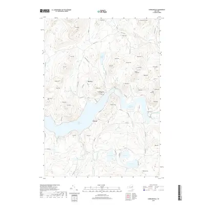
2019 Map of Conklingville
USGS Topo · Published 2019About this map
Great Sacandaga Lake dominates this mountain landscape, its sprawling waters filling the valley south of Conklingville. This settlement and the nearby Allentown sit at the northern edge of the reservoir, where the Sacandaga River continues its eastward course. The terrain is defined by a dense network of peaks named for local families and landmarks, including Hammond Lot Mtn, Springer Mtn, and Menzie Mtn. In the southern reaches, a cluster of smaller water bodies such as Efner Lake, Jenny Lake, and Hunt Lake suggests a long-standing recreational or seasonal character for the area.
Find a feature on this map
90 named features on this map. Tap any name to fly to it.
Don’t see what you’re looking for? This feature index may not catch every label — zoom into the map to look around manually.
Map Details
Editions of this 2019 Conklingville Map
This is the sole edition of this map. No revisions or reprints were ever made.
Other maps of this area

1899 · Broadalbin
USGS Topo · 1:62,500

1902 · Broadalbin
USGS Topo · 1:62,500

1902 · Saratoga
USGS Topo · 1:62,500

1903 · Luzerne
USGS Topo · 1:62,500

1910 · Stony Creek
USGS Topo · 1:62,500

1935 · Corinth
USGS Topo · 1:24,000

1942 · Saratoga
USGS Topo · 1:62,500

1945 · Edinburg
USGS Topo · 1:24,000
1946 · Edinburg
USGS Topo · 1:24,000
1947 · Saratoga
USGS Topo · 1:62,500