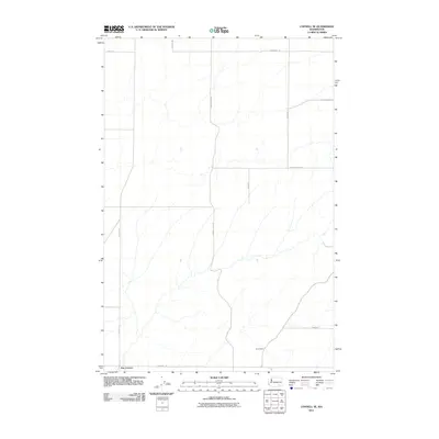
2011 Map of Connell SE
USGS Topo · Published 2011About this map
Drumheller and the small settlement of Five Corners anchor this rural landscape in Franklin County, defined by its extensive network of agricultural roads and drainage patterns. The map documents a sparsely populated but highly organized section of Eastern Washington as it appeared in the early 21st century. The terrain is crisscrossed by essential farm-to-market routes like Fishook Elgin Rd, Mesa Kahlotus Rd, and Bauermeister Rd, which facilitate movement through the dry coulee and upland regions. Named landmarks such as Gertler Rd and Overturf Rd reflect the generational imprint of local farming families on the geography. This survey provides a clear view of the land division and transportation infrastructure essential to the region's wheat or ranching operations before more modern developments changed the local character.
Find a feature on this map
12 named features on this map. Tap any name to fly to it.
Don’t see what you’re looking for? This feature index may not catch every label — zoom into the map to look around manually.
Map Details
Editions of this 2011 Connell SE Map
This is the sole edition of this map. No revisions or reprints were ever made.
Other maps of this area

1915 · Wallulah
USGS Topo · 1:96,000

1916 · Connell
USGS Topo · 1:125,000

1918 · Connell
USGS Topo · 1:125,000

1918 · Wallula
USGS Topo · 1:125,000

1953 · Walla Walla
USGS Topo · 1:250,000

1958 · Walla Walla
USGS Topo · 1:250,000

1963 · Rye Grass Coulee
USGS Topo · 1:24,000

1964 · Levey NE
USGS Topo · 1:24,000

1966 · Snake River
USGS Topo · 1:24,000
1970 · Burr Canyon
USGS Topo · 1:24,000