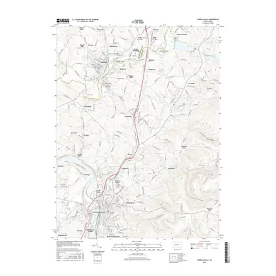
2016 Map of Connellsville
USGS Topo · Published 2016About this map
The Youghiogheny River carves a deep arc through this portion of Fayette and Westmoreland counties, serving as the historical lifeblood for industrial settlements like Adelaide, Broad Ford, and Morgan. This landscape is defined by the dense clustering of coal-era communities and the ridge-and-valley terrain that dictated their development. From the borough of Scottdale in the north to the larger hub of Connellsville in the south, the map reveals a complex network of residential blocks and cemeteries, including Hill Grove Cem and Saint Josephs Cem.
Find a feature on this map
80 named features on this map. Tap any name to fly to it.
Don’t see what you’re looking for? This feature index may not catch every label — zoom into the map to look around manually.
Map Details
Editions of this 2016 Connellsville Map
This is the sole edition of this map. No revisions or reprints were ever made.
Other maps of this area

1900 · Uniontown
USGS Topo · 1:62,500

1902 · Connellsville
USGS Topo · 1:62,500

1922 · Confluence
USGS Topo · 1:62,500

1922 · Donegal
USGS Topo · 1:62,500

1931 · Connellsville
USGS Topo · 1:62,500

1931 · Uniontown
USGS Topo · 1:62,500

1931 · Confluence
USGS Topo · 1:62,500

1933 · Confluence
USGS Topo · 1:62,500

1935 · Donegal
USGS Topo · 1:62,500

1936 · Connellsville
USGS Topo · 1:62,500