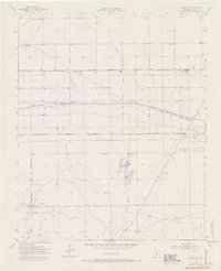
1955 Map of Conner SW
USGS Topo · Published 1970About this map
The California Aqueduct carves a massive diagonal path across this southern San Joaquin Valley landscape, captured here in a transitional state during the mid-1950s with late-1960s revisions. This area of Kern County is defined by its industrial and agricultural infrastructure, where an extensive network of pipelines, ditches, and drains supports local production. The settlement pattern is sparse and functional, centered around sites like the Cotton Gin and the Lakeview Labor Camp near the junction of Copus Road and Old River Road.
Find a feature on this map
24 named features on this map. Tap any name to fly to it.
Don’t see what you’re looking for? This feature index may not catch every label — zoom into the map to look around manually.
Map Details
Editions of this 1955 Conner SW Map
4 editions found
Other maps of this area

1903 · Mt. Pinos
USGS Topo · 1:125,000

1910 · Buena Vista Lake
USGS Topo · 1:125,000

1912 · Buena Vista Lake
USGS Topo · 1:125,000

1929 · Mouth of Kern
USGS Topo · 1:31,680

1930 · Millux
USGS Topo · 1:31,680

1930 · Conner
USGS Topo · 1:31,680

1931 · Pentland Junction
USGS Topo · 1:31,680

1931 · Hayes Ranch
USGS Topo · 1:31,680

1932 · Mouth of Kern
USGS Topo · 1:31,680

1933 · Hayes Ranch
USGS Topo · 1:31,680