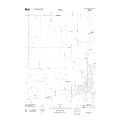
2013 Map of Connersville
USGS Topo · Published 2013About this map
The Whitewater River and the historic Whitewater Canal corridor define the eastern edge of this landscape, reflecting Indiana's nineteenth-century industrial and transport roots. In the early 2000s, the rural character of Fayette County persists through a network of small settlements and crossing points like Longwood Crossing, Tyner Crossing, and Bunker Hill. The terrain is drained by a complex system of waterways including Williams Cr, Lick Cr, and Shaker Run, which weave between the county road grid. Commercial and aviation activity is centered at Mettel Field Airport north of the urban reach of Connersville. From the village of Bentonville in the northwest to Beesons in the northeast, the map reveals a transition from open farmland to the specialized infrastructure of the Whitewater valley.
Find a feature on this map
88 named features on this map. Tap any name to fly to it.
Don’t see what you’re looking for? This feature index may not catch every label — zoom into the map to look around manually.
Map Details
Editions of this 2013 Connersville Map
This is the sole edition of this map. No revisions or reprints were ever made.
Other maps of this area

1948 · Lewisville
USGS Topo · 1:24,000

1950 · Lewisville
USGS Topo · 1:24,000

1953 · Cincinnati
USGS Topo · 1:250,000

1956 · Everton
USGS Topo · 1:24,000

1956 · Alpine
USGS Topo · 1:24,000

1956 · Brownsville
USGS Topo · 1:24,000

1956 · Connersville
USGS Topo · 1:24,000

1957 · Cincinnati
USGS Topo · 1:250,000

1959 · New Salem
USGS Topo · 1:24,000

1959 · Falmouth
USGS Topo · 1:24,000