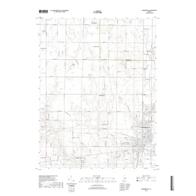
2019 Map of Connersville
USGS Topo · Published 2019About this map
Connersville and its surrounding Fayette County landscape are defined by the path of the Whitewater River and the historical engineering of the Whitewater Canal. This modern survey illustrates the dense street grid of the city, transitioning into a pastoral terrain dotted with numerous family and community burial grounds such as Wiley Chapel and Lick Creek Cem. The influence of the local aviation economy is visible at Dungan Airport and Mettel Field, while the northern reaches of the quadrangle include the rural crossroads of Bentonville and Beesons.
Find a feature on this map
151 named features on this map. Tap any name to fly to it.
Don’t see what you’re looking for? This feature index may not catch every label — zoom into the map to look around manually.
Map Details
Editions of this 2019 Connersville Map
This is the sole edition of this map. No revisions or reprints were ever made.
Other maps of this area

1948 · Lewisville
USGS Topo · 1:24,000

1950 · Lewisville
USGS Topo · 1:24,000

1953 · Cincinnati
USGS Topo · 1:250,000

1956 · Everton
USGS Topo · 1:24,000

1956 · Alpine
USGS Topo · 1:24,000

1956 · Brownsville
USGS Topo · 1:24,000

1956 · Connersville
USGS Topo · 1:24,000

1957 · Cincinnati
USGS Topo · 1:250,000

1959 · New Salem
USGS Topo · 1:24,000

1959 · Falmouth
USGS Topo · 1:24,000