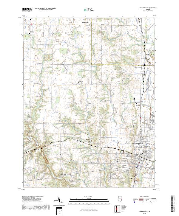
2022 Map of Connersville
USGS Topo · Published 2022About this map
The Fayette County Courthouse serves as the focal point for the city of Connersville, situated along the Whitewater River. This area illustrates a complex layering of transportation history, where the modern industrial presence of Mettel Field and the Whitewater Valley Railroad coexist with the path of the historic Whitewater Canal near Beesons. The landscape transitions from the urban density of the county seat to the agricultural and natural lands of the Shrader-Weaver Nature Preserve.
Find a feature on this map
135 named features on this map. Tap any name to fly to it.
Don’t see what you’re looking for? This feature index may not catch every label — zoom into the map to look around manually.
Map Details
Editions of this 2022 Connersville Map
This is the sole edition of this map. No revisions or reprints were ever made.
Other maps of this area

1948 · Lewisville
USGS Topo · 1:24,000

1950 · Lewisville
USGS Topo · 1:24,000

1953 · Cincinnati
USGS Topo · 1:250,000

1956 · Everton
USGS Topo · 1:24,000

1956 · Alpine
USGS Topo · 1:24,000

1956 · Brownsville
USGS Topo · 1:24,000

1956 · Connersville
USGS Topo · 1:24,000

1957 · Cincinnati
USGS Topo · 1:250,000

1959 · New Salem
USGS Topo · 1:24,000

1959 · Falmouth
USGS Topo · 1:24,000