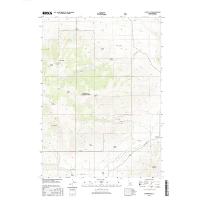
2017 Map of Connor Ridge
USGS Topo · Published 2017About this map
The Sawtooth National Forest dominates this section of the Albion Mountains, where steep drainages and prominent ridges define the high-desert terrain of Cassia County. The landscape is characterized by a network of seasonal and perennial waters such as Cassia Cr and Howell Cr, alongside vital watering points like Howell Spring and Sibley Spring. This topographical survey captures the rural infrastructure of southern Idaho, featuring the small settlement of Connor at the junction of Elba-Almo Rd and Durfee Rd.
Find a feature on this map
45 named features on this map. Tap any name to fly to it.
Don’t see what you’re looking for? This feature index may not catch every label — zoom into the map to look around manually.
Map Details
Editions of this 2017 Connor Ridge Map
This is the sole edition of this map. No revisions or reprints were ever made.
Other maps of this area

1954 · Pocatello
USGS Topo · 1:250,000

1958 · Pocatello
USGS Topo · 1:250,000

1964 · View
USGS Topo · 1:24,000

1968 · Cache Peak
USGS Topo · 1:24,000

1968 · Idahome
USGS Topo · 1:24,000

1968 · Elba
USGS Topo · 1:24,000

1968 · Kane Canyon
USGS Topo · 1:24,000

1968 · Mount Harrison
USGS Topo · 1:24,000

1968 · Nibbs Creek
USGS Topo · 1:24,000

1968 · Albion
USGS Topo · 1:24,000