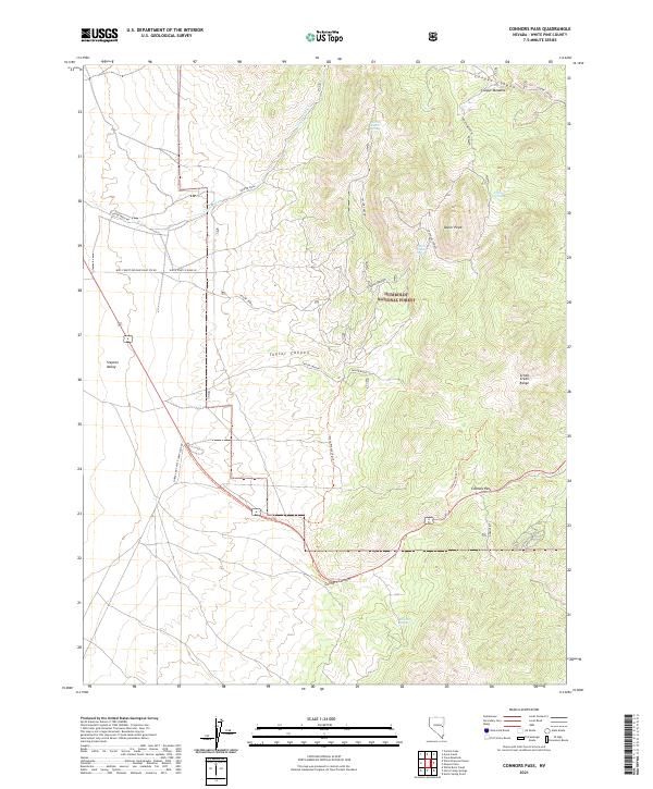
2021 Map of Connors Pass
USGS Topo · Published 2021About this map
Taylor Ruins and the adjacent Taylor Town indicate the archaeological and historical footprint of human activity within the eastern slopes of the Schell Creek Range. This high-altitude landscape is characterized by its vital water sources, such as North Taylor Spring, South Taylor Spring, and Crethers Springs, which supported both the mining era and the ranching activity within the Humboldt National Forest.
Find a feature on this map
28 named features on this map. Tap any name to fly to it.
Don’t see what you’re looking for? This feature index may not catch every label — zoom into the map to look around manually.
Map Details
Editions of this 2021 Connors Pass Map
This is the sole edition of this map. No revisions or reprints were ever made.
Other maps of this area

1952 · Ely
USGS Topo · 1:125,000

1956 · Lund
USGS Topo · 1:250,000

1956 · Ely
USGS Topo · 1:250,000

1958 · Comins Lake
USGS Topo · 1:24,000

1958 · Ely
USGS Topo · 1:62,500

1959 · Ely
USGS Topo · 1:250,000

1959 · Connors Pass
USGS Topo · 1:62,500

1960 · Lund
USGS Topo · 1:250,000

1963 · Ely
USGS Topo · 1:250,000
1973 · White Rock Creek
USGS Topo · 1:24,000