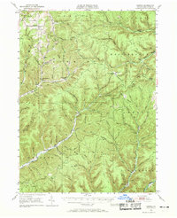
1947 Map of Conrad
USGS Topo · Published 1969About this map
Conrad and the surrounding high-altitude plateaus of Potter County are depicted here shortly after the Second World War. The landscape is defined by the deep incisions of the East Fork Sinnemahoning Creek and the West Branch Pine Creek, creating a network of ridges and hollows that historically challenged early transit. Small settlements like Borie and Logue are shown alongside essential community landmarks, including the United Brethren Ch and several family-named burial grounds like Ayers Hill Cem and Jackson Cem.
Find a feature on this map
96 named features on this map. Tap any name to fly to it.
Don’t see what you’re looking for? This feature index may not catch every label — zoom into the map to look around manually.
Map Details
Editions of this 1947 Conrad Map
4 editions found

Other maps of this area

1899 · Gaines
USGS Topo · 1:62,500

1900 · Gaines
USGS Topo · 1:62,500

1932 · Genesee
USGS Topo · 1:62,500

1934 · Coudersport
USGS Topo · 1:48,000

1937 · Genesee
USGS Topo · 1:62,500

1938 · Coudersport
USGS Topo · 1:62,500

1943 · Hyner
USGS Topo · 1:62,500

1945 · Driftwood
USGS Topo · 1:48,000

1945 · First Fork
USGS Topo · 1:24,000

1946 · Young Womans Creek
USGS Topo · 1:24,000
Featured Places
- Sweden Township, PA
- Abbott Township, PA
- Wharton Township, PA
- Borie, Summit Township
- West Branch Township, PA