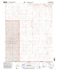
1998 Map of Conrad SW
USGS Topo · Published 2001About this map
Rita Blanca National Grassland dominates the western portion of this High Plains landscape at the turn of the millennium. Spanning the border of Cimarron County, Oklahoma, and Dallam County, Texas, the terrain is characterized by the wide valley of the Beaver River and a scattering of isolated water resources identified simply as wells. The map documents a sparsely populated ranching and conservation environment where the jurisdictional boundary between states intersects the management areas of the Forest Service. Within the Cleveland township area, the presence of a Landing Strip suggests the importance of aerial access in this expansive, open country. This survey provides a precise record of the land use and administrative boundaries in the Oklahoma Panhandle just before the 21st century.
Find a feature on this map
6 named features on this map. Tap any name to fly to it.
Don’t see what you’re looking for? This feature index may not catch every label — zoom into the map to look around manually.
Map Details
Editions of this 1998 Conrad SW Map
This is the sole edition of this map. No revisions or reprints were ever made.
Other maps of this area

1954 · Dalhart
USGS Topo · 1:250,000

1958 · Dalhart
USGS Topo · 1:250,000

1962 · Dalhart
USGS Topo · 1:250,000

1964 · Stratford 2 NE
USGS Topo · 1:24,000

1969 · Boise City
USGS Topo · 1:24,000

1969 · Boise City SE
USGS Topo · 1:24,000

1971 · Sampsel Lake
USGS Topo · 1:24,000

1971 · Conrad NW
USGS Topo · 1:24,000

1971 · Conrad SW
USGS Topo · 1:24,000
1971 · Conrad
USGS Topo · 1:24,000