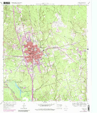
1985 Map of Conroe
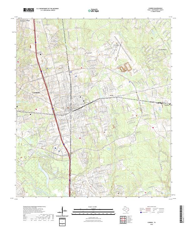
USGS Topo · Published 1985About this map
Lake Conroe and the surrounding piney woods of Southeast Texas anchor this mid-1980s survey, illustrating a region defined by its timber heritage and rapid suburbanization. The map documents the sprawling Sam Houston National Forest to the north and the smaller Jones State Forest, which provide a sharp contrast to the developing residential corridors around Conroe and Tomball. A dense network of transportation routes, including the Missouri Pacific RR and Atchison Topeka and Santa Fe RR, reveals how the timber and oil economies shaped the layout of local settlements.
Find a feature on this map
95 named features on this map. Tap any name to fly to it.
Don’t see what you’re looking for? This feature index may not catch every label — zoom into the map to look around manually.
Map Details
Editions of this 1985 Conroe Map
2 editions found
Historical Maps of Porter Through Time
3 maps found