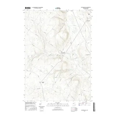
2016 Map of Constableville
USGS Topo · Published 2016About this map
The village of Constableville serves as the focal point of this Lewis County survey, situated where the Sugar River meets the eastern slopes of the Tug Hill plateau. The landscape is defined by its watercourses, including the White River and the winding N Br Sugar River, which carve through the high terrain. Historical settlement patterns are evident in the concentration of local burial grounds and religious sites, such as the Rural Cem and Saint Marys Cem near the town center, and the more remote Saint Michaels Cem at Mohawk Hill. The northern portion of the map transitions toward Turin and Lyons Falls, showing a network of rural routes like Crofoot Hill Rd and Swackhammer Rd that connected these early agricultural and timbering communities to the regional river economy.
Find a feature on this map
75 named features on this map. Tap any name to fly to it.
Don’t see what you’re looking for? This feature index may not catch every label — zoom into the map to look around manually.
Map Details
Editions of this 2016 Constableville Map
This is the sole edition of this map. No revisions or reprints were ever made.
Other maps of this area

1904 · Boonville
USGS Topo · 1:62,500

1905 · Port Leyden
USGS Topo · 1:62,500

1905 · Taberg
USGS Topo · 1:62,500

1906 · Highmarket
USGS Topo · 1:62,500

1907 · Port Leyden
USGS Topo · 1:62,500

1940 · Port Leyden
USGS Topo · 1:62,500

1943 · High Market
USGS Topo · 1:24,000
1943 · Page
USGS Topo · 1:24,000
1944 · Page
USGS Topo · 1:31,680

1944 · Point Rock
USGS Topo · 1:31,680