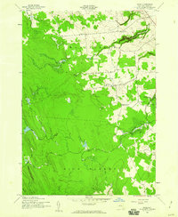
1943 Map of Page
USGS Topo · Published 1960About this map
Martinsburg and High Market define the rural character of this northern New York landscape during the early 1940s. The region is marked by a network of small, numbered district schools, including School No 17, School No 15, and School No 3, which serve scattered farming settlements like Wetmore and McGraw Corners. The eastern edge of the survey features the dramatic topography of Whetstone Gulf, which is preserved within Whetstone Gulf State Park.
Find a feature on this map
23 named features on this map. Tap any name to fly to it.
Don’t see what you’re looking for? This feature index may not catch every label — zoom into the map to look around manually.
Map Details
Editions of this 1943 Page Map
2 editions found
Other maps of this area

1902 · Carthage
USGS Topo · 1:62,500

1904 · Carthage
USGS Topo · 1:62,500

1905 · Port Leyden
USGS Topo · 1:62,500

1906 · Highmarket
USGS Topo · 1:62,500

1907 · Port Leyden
USGS Topo · 1:62,500

1911 · Lowville
USGS Topo · 1:62,500

1913 · Lowville
USGS Topo · 1:62,500

1940 · Port Leyden
USGS Topo · 1:62,500
1943 · New Boston
USGS Topo · 1:31,680

1943 · West Lowville
USGS Topo · 1:31,680