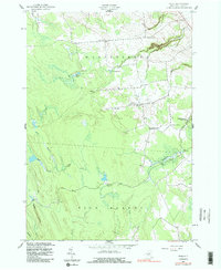
1943 Map of Page
USGS Topo · Published 1986About this map
The town of Page and the surrounding rural landscape of Lewis County are captured here just after the start of World War II. The terrain is defined by its transition between the town lines of Martinsburg, Turin, and High Market, where small agrarian crossroads like Wetmore and McGraw Corners once served as local hubs. The abundance of numbered schoolhouses, such as School No 12 and School No 15, reflects the decentralized rural education system of the early 20th century.
Find a feature on this map
24 named features on this map. Tap any name to fly to it.
Don’t see what you’re looking for? This feature index may not catch every label — zoom into the map to look around manually.
Map Details
Editions of this 1943 Page Map
2 editions found
Other maps of this area

1902 · Carthage
USGS Topo · 1:62,500

1904 · Carthage
USGS Topo · 1:62,500

1905 · Port Leyden
USGS Topo · 1:62,500

1906 · Highmarket
USGS Topo · 1:62,500

1907 · Port Leyden
USGS Topo · 1:62,500

1911 · Lowville
USGS Topo · 1:62,500

1913 · Lowville
USGS Topo · 1:62,500

1940 · Port Leyden
USGS Topo · 1:62,500
1943 · New Boston
USGS Topo · 1:31,680

1943 · West Lowville
USGS Topo · 1:31,680