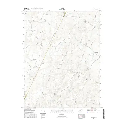
2016 Map of Constantine
USGS Topo · Published 2016About this map
Pierce Mill and the surrounding homesteads of the Breckinridge and Hardin county line are captured here in a landscape defined by deep creek valleys and high ridges. The Rough River snakes through the southern half of the sheet, fed by several named tributaries including Drakes Cr and Linders Cr. The rural settlement pattern is anchored by small hubs like Constantine and Dyer, with many family names preserved in the local road network, such as J R Alexander Ln and Jess Hoskinson Ln.
Find a feature on this map
69 named features on this map. Tap any name to fly to it.
Don’t see what you’re looking for? This feature index may not catch every label — zoom into the map to look around manually.
Map Details
Editions of this 2016 Constantine Map
This is the sole edition of this map. No revisions or reprints were ever made.
Other maps of this area

1928 · Hardinsburg
USGS Topo · 1:48,000

1931 · Hardinsburg
USGS Topo · 1:62,500

1932 · Big Clifty
USGS Topo · 1:62,500

1941 · Ekron
USGS Topo · 1:62,500

1947 · Garfield
USGS Topo · 1:24,000

1947 · Hardinsburg
USGS Topo · 1:62,500

1947 · Ekron
USGS Topo · 1:62,500
1948 · Flaherty
USGS Topo · 1:24,000
1948 · Big Spring
USGS Topo · 1:24,000

1949 · Constantine
USGS Topo · 1:24,000