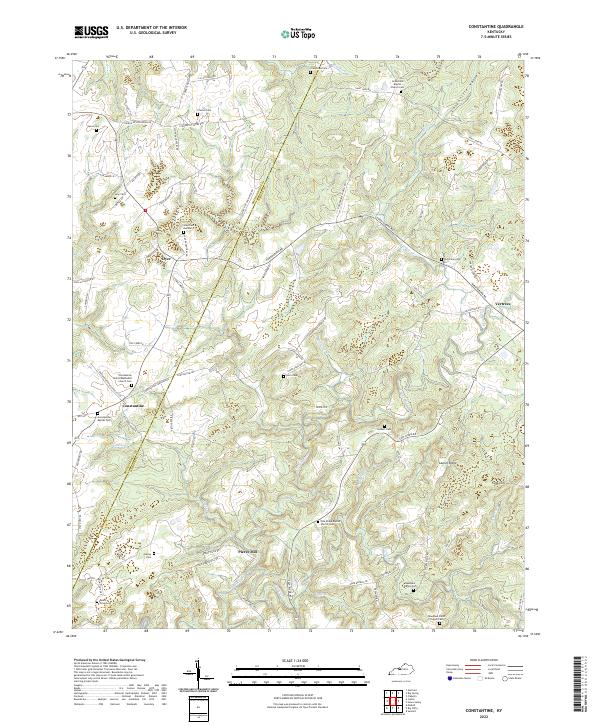
2022 Map of Constantine
USGS Topo · Published 2022About this map
The Rough River snakes through the center of this terrain, defining the local topography where the Breckinridge and Hardin county lines meet. The settlement of Constantine and the rural community of Dyer serve as primary points of orientation in a landscape characterized by deep drainages like Losenville Valley and Drakes Cr. Family history is deeply rooted here, with numerous small burial grounds and churches such as the Grandview Baptist Church Cem and the Needham Smith Chapel Cem scattered across the uplands.
Find a feature on this map
87 named features on this map. Tap any name to fly to it.
Don’t see what you’re looking for? This feature index may not catch every label — zoom into the map to look around manually.
Map Details
Editions of this 2022 Constantine Map
This is the sole edition of this map. No revisions or reprints were ever made.
Other maps of this area

1928 · Hardinsburg
USGS Topo · 1:48,000

1931 · Hardinsburg
USGS Topo · 1:62,500

1932 · Big Clifty
USGS Topo · 1:62,500

1941 · Ekron
USGS Topo · 1:62,500

1947 · Garfield
USGS Topo · 1:24,000

1947 · Hardinsburg
USGS Topo · 1:62,500

1947 · Ekron
USGS Topo · 1:62,500
1948 · Flaherty
USGS Topo · 1:24,000
1948 · Big Spring
USGS Topo · 1:24,000

1949 · Constantine
USGS Topo · 1:24,000