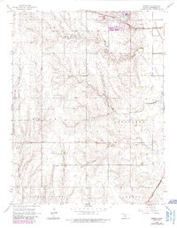
1964 Map of Conway
USGS Topo · Published 1985About this map
Conway and its surrounding agricultural townships serve as the focus of this mid-1960s survey of central Kansas. The landscape is defined by a dense network of rural infrastructure, including community pillars such as Monitor Sch, Plainview Sch, and West Liberty Ch. The presence of the Amish Ch and the Amish Cem reflects the cultural heritage and traditional land-use patterns of the region's inhabitants.
Find a feature on this map
17 named features on this map. Tap any name to fly to it.
Don’t see what you’re looking for? This feature index may not catch every label — zoom into the map to look around manually.
Map Details
Editions of this 1964 Conway Map
3 editions found
Other maps of this area

1891 · Hutchinson
USGS Topo · 1:125,000

1893 · Hutchinson
USGS Topo · 1:125,000

1955 · Hutchinson
USGS Topo · 1:250,000

1959 · Hutchinson
USGS Topo · 1:250,000

1964 · Windom SW
USGS Topo · 1:24,000

1964 · Conway
USGS Topo · 1:24,000

1965 · Mc Pherson South
USGS Topo · 1:24,000

1965 · Halstead NW
USGS Topo · 1:24,000
1965 · Mc Pherson North
USGS Topo · 1:24,000
1965 · Hutchinson NW
USGS Topo · 1:24,000