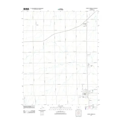
2012 Map of Conway Springs
USGS Topo · Published 2012About this map
Conway Springs anchor the southeastern corner of this Kansas landscape, defined by a strict section-line road grid and the meandering paths of Slate Cr and its tributaries. The settlement of Viola sits near the northern boundary, while the smaller locality of Anness occupies the northwestern reach, illustrating the dispersed rural community structure of the early 21st century. The local infrastructure reflects both utility and community history, from the Conway Springs Water Tower and Viola Wastewater Treatment Facility to quiet landmarks like Viola Cem and Saint Josephs Cem. Aviation activity is marked at Wamsley Field Airport, tucked between north-south routes like N Ryan Rd and N Victor Dr. This survey captures the steady agricultural rhythm of the plains, where naming conventions often follow local families, as seen in corridors like Anness Rd and N Morris Rd.
Find a feature on this map
49 named features on this map. Tap any name to fly to it.
Don’t see what you’re looking for? This feature index may not catch every label — zoom into the map to look around manually.
Map Details
Editions of this 2012 Conway Springs Map
This is the sole edition of this map. No revisions or reprints were ever made.
Other maps of this area

1889 · Cheney
USGS Topo · 1:125,000

1889 · Caldwell
USGS Topo · 1:125,000

1891 · Cheney
USGS Topo · 1:125,000

1893 · Caldwell
USGS Topo · 1:125,000

1897 · Caldwell
USGS Topo · 1:125,000

1901 · Cheney
USGS Topo · 1:125,000

1955 · Wichita
USGS Topo · 1:250,000

1958 · Wichita
USGS Topo · 1:250,000

1965 · Cheney SE
USGS Topo · 1:24,000
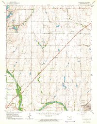
1965 · Clearwater
USGS Topo · 1:24,000