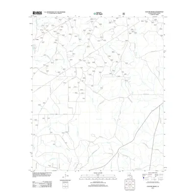
2012 Map of Coochie Brake
USGS Topo · Published 2012About this map
Couley stands as a primary settlement in this part of Winn Parish, situated along a network of rural roads that weave through a landscape defined by several winding watercourses. The drainage patterns of central Louisiana are clearly visible here, with Nantachie Cr and Iatt Cr carving through the terrain alongside smaller tributaries like Cypress Br and Robins Cr. For those researching local history, the Kimbrell Cem is a significant genealogical landmark located near the junction of several rural routes in the southwest. A distinct pattern of parish roads, including Double Church Rd, Coochie Brake Rd, and Waterwell Rd, suggests a long-standing rural community structure where transportation followed the ridges and creek beds of the piney woods.
Find a feature on this map
150 named features on this map. Tap any name to fly to it.
Don’t see what you’re looking for? This feature index may not catch every label — zoom into the map to look around manually.
Map Details
Editions of this 2012 Coochie Brake Map
This is the sole edition of this map. No revisions or reprints were ever made.
Other maps of this area

1932 · Colfax NW
USGS Topo · 1:31,680

1935 · Verda
USGS Topo · 1:31,680

1936 · Colfax
USGS Topo · 1:62,500

1937 · Montgomery
USGS Topo · 1:62,500

1942 · Montgomery
USGS Topo · 1:62,500

1945 · Montgomery
USGS Topo · 1:62,500

1949 · Calvin SE
USGS Topo · 1:31,680

1949 · Calvin NE
USGS Topo · 1:31,680

1949 · Calvin NW
USGS Topo · 1:31,680

1949 · Calvin SW
USGS Topo · 1:31,680