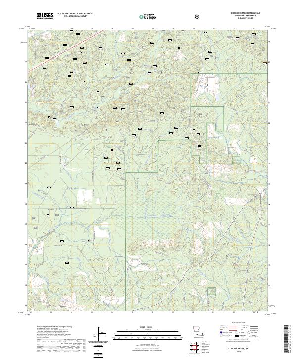
2024 Map of Coochie Brake
USGS Topo · Published 2024About this map
Kisatchie National Forest dominates this section of Winn Parish, where the wetlands of Coochie Brake form a distinctive ecological and hydrologic center. The terrain is defined by a dense network of drainages, including Nantachie Creek, Kensie Creek, and Mars Hill Creek, which flow through the forested uplands. While the landscape is primarily managed forest, early settlement patterns remain visible through established family-named landmarks and rural infrastructure. Kimbrell Cem and the surrounding network of parish roads, such as Harrisonburg Rd and Wheeling Rd, connect the scattered homesteads. To the north, Couley Creek and Tatt Creek carve through the woods, while the southeastern corner features Dantigo Creek and the beginnings of the Harrisonburg community. The map provides a detailed view of the interaction between the natural wetland systems of the brake and the forestry roads that provide access to the timberlands.
Find a feature on this map
153 named features on this map. Tap any name to fly to it.
Don’t see what you’re looking for? This feature index may not catch every label — zoom into the map to look around manually.
Map Details
Editions of this 2024 Coochie Brake Map
This is the sole edition of this map. No revisions or reprints were ever made.
Other maps of this area

1932 · Colfax NW
USGS Topo · 1:31,680

1935 · Verda
USGS Topo · 1:31,680

1936 · Colfax
USGS Topo · 1:62,500

1937 · Montgomery
USGS Topo · 1:62,500

1942 · Montgomery
USGS Topo · 1:62,500

1945 · Montgomery
USGS Topo · 1:62,500

1949 · Calvin SE
USGS Topo · 1:31,680

1949 · Calvin NE
USGS Topo · 1:31,680

1949 · Calvin NW
USGS Topo · 1:31,680

1949 · Calvin SW
USGS Topo · 1:31,680