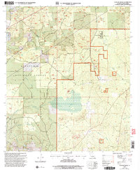
2003 Map of Coochie Brake
USGS Topo · Published 2005About this map
Coochie Brake dominates the central landscape of this Winn Parish quadrangle, a significant wetland feature surrounded by the wooded expanses of the Kisatchie National Forest. The map documents a rural transition where traditional landmarks like Bethlehem Ch and Couley Ch sit alongside modern institutional developments such as the Winn Correctional Center. The terrain is defined by a network of drainage systems, including Latt Creek and Nantachie Creek, which cut through the pine-covered hills near Black Mountain.
Find a feature on this map
34 named features on this map. Tap any name to fly to it.
Don’t see what you’re looking for? This feature index may not catch every label — zoom into the map to look around manually.
Map Details
Editions of this 2003 Coochie Brake Map
This is the sole edition of this map. No revisions or reprints were ever made.
Other maps of this area

1932 · Colfax NW
USGS Topo · 1:31,680

1935 · Verda
USGS Topo · 1:31,680

1936 · Colfax
USGS Topo · 1:62,500

1937 · Montgomery
USGS Topo · 1:62,500

1942 · Montgomery
USGS Topo · 1:62,500

1945 · Montgomery
USGS Topo · 1:62,500

1949 · Calvin SE
USGS Topo · 1:31,680

1949 · Calvin NE
USGS Topo · 1:31,680

1949 · Calvin NW
USGS Topo · 1:31,680

1949 · Calvin SW
USGS Topo · 1:31,680