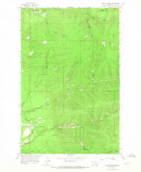
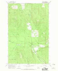
1964 Map of Cook Mountain
USGS Topo · Published 1967About this map
Lolo National Forest and Thompson River State Forest converge in this mid-1960s study of the high timberlands at the Flathead Co Sanders Co boundary. The landscape is defined by its drainage systems, with Big Rock Creek and Chippy Creek carving paths through steep canyons and gulches. One of the most distinctive features is the Pack Trail network, which provides the primary means of traversal through the dense forests and across landmarks like Broken Nose Gulch. The Thompson River flows through the southwestern corner, joined by tributaries such as Bear Creek and the dramatically named Hell Roaring Canyon. Rising as a central waypoint, Cook Mountain anchors the southern half of the quadrangle, illustrating the complex topography of the Cabinet Mountains region before modern road development was extensive.
Find a feature on this map
13 named features on this map. Tap any name to fly to it.
Don’t see what you’re looking for? This feature index may not catch every label — zoom into the map to look around manually.
Map Details
Editions of this 1964 Cook Mountain Map
This is the sole edition of this map. No revisions or reprints were ever made.
Other maps of this area

1937 · Thompson Falls
USGS Topo · 1:125,000

1956 · Wallace
USGS Topo · 1:250,000

1960 · Wallace
USGS Topo · 1:250,000

1964 · Calico Creek
USGS Topo · 1:24,000

1964 · Coney Peak
USGS Topo · 1:24,000
1964 · Shroder Creek
USGS Topo · 1:24,000

1964 · Murr Peak
USGS Topo · 1:24,000
1964 · Bassoo Peak
USGS Topo · 1:24,000
1964 · Loneman Creek
USGS Topo · 1:24,000
1966 · Bend
USGS Topo · 1:24,000