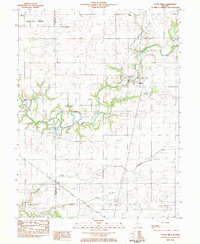
1983 Map of Cooks Mills
USGS Topo · Published 1983About this map
The Kaskaskia River meanders through this portion of Coles County, shaping a landscape defined by the intersection of traditional agriculture and the energy industry. Small rural clusters like Cooks Mills and Fuller anchor the local community, while the presence of the Consolidated Oil Field and the North Mattoon Oil Field indicates the importance of mineral extraction to the local economy during this era. The Illinois Central Gulf railroad cuts through the southern terrain, providing a vital transportation link near the settlement of Coles.
Find a feature on this map
26 named features on this map. Tap any name to fly to it.
Don’t see what you’re looking for? This feature index may not catch every label — zoom into the map to look around manually.
Map Details
Editions of this 1983 Cooks Mills Map
This is the sole edition of this map. No revisions or reprints were ever made.
Other maps of this area

1934 · Mattoon
USGS Topo · 1:62,500

1935 · Arcola
USGS Topo · 1:48,000

1935 · Sullivan
USGS Topo · 1:48,000

1937 · Mattoon
USGS Topo · 1:62,500

1940 · Sullivan
USGS Topo · 1:62,500

1940 · Arcola
USGS Topo · 1:62,500

1947 · Stewardson
USGS Topo · 1:62,500

1949 · Stewardson
USGS Topo · 1:62,500

1958 · Decatur
USGS Topo · 1:250,000

1961 · Decatur
USGS Topo · 1:250,000